Thousands of years ago, near what is now the shared border of Mongolia, China, and Russia, water sat frozen in mountain glaciers that extended for miles. At the end of the Ice Age, with temperatures rising rapidly, the ice began to melt, and water poured across the landscape, carving out wide valleys. Granite silt and ice ground into the Earth, polishing smooth the sandstone bedrock.
As the ice receded, gray till, sediment, and boulders remained in the form of moraine ridges that describe where the glaciers once sat. Over millennia, these jagged landforms slowly weathered. Plants began to grow, and the grass fed newly arrived animals — yak, goats, and sheep, herded there by people who, like the vanished glaciers, have left signs of their own. Bands of early Turkic, Eurasian, and Mongol people came and left, nomadic groups who left burial mounds, memorials, and petroglyphs.
And now, in 2016, a different group is trudging up this valley wearing colorful jackets and carrying the latest technology. Up-valley, a team of men on horseback walk along a thin trail leading camels, carrying supplies for a month-long science expedition — drills, GPS units, and a carcass of a freshly slaughtered sheep. Aaron Putnam is an hour behind them, hiking with a team of students, research assistants, and local guides. He’s a glacial geologist from the University of Maine, and he and his team are here to collect the surface layer of granite boulders implanted in those moraines that formed at the margins of the glacier. I’m with them as an embedded reporter.
“This is the nexus of climate, humans, and geology, and it is all happening right here.”
The team hopes that data derived from the rock can tell them when the ice melted. “This was the singular most powerful, most important climate event in human history. It allowed us to flourish,” Putnam says. “But we don’t know why that happened.” Putnam is trying to determine what caused the Ice Age’s demise; the answer could help us identify the triggers that cause abrupt climate change.
The remaining ice is the Potanin Glacier, the country’s largest today. Putnam studies glaciers for what they can tell us about climate change of the past, but also for what they say about current warming. What caused the melting of ice sheets and alpine glaciers roughly 20,000 years ago is one of earth science’s most enduring questions, and Putnam is developing a chronology of glacial retreat at the end of the Ice Age. He believes information extracted here holds the key to unlocking this mystery. Solving this problem could reduce uncertainty in predictive models that forecast the impact of anthropogenic climate change and vastly improve our ability to adapt to future warming.
Here in the deep interior of Asia, the grassland steppe gives way to shrubby desert and, now and then, timberline. The moraines are perfectly preserved. There is no forest to obscure them from view. For a researcher interested in geomorphology, it’s a total playground — and one that has been minimally studied. Samples from the glacial moraines here approximate a record of summer temperatures spanning thousands of years — new information that scientists have never had before.
What caused the end of the Ice Age? For a time, researchers thought that CO2 may have been the trigger, but Putnam doesn’t think so. Neither does Michael Kaplan, a researcher at Columbia University who is also working on this problem. At least, they don’t think CO2 was the singular trigger. “We don’t think CO2 could be the initial smoking gun because some retreat happens before CO2 increases significantly,” Kaplan says. Researchers have a unified record of warming across the Southern Hemisphere, but, Kaplan says, “the outstanding question is to know what happened in the Northern Hemisphere” — precisely what Putnam hopes to learn from his work in Mongolia.
And it is with no small effort that he arrived here at all. More than five years ago, Putnam was scrutinizing pixilated satellite images to see if the place was right, unsure even if it would be politically feasible to collect samples. He worried that an American researcher would be denied the necessary permits to collect samples in a national park so near China and Russia. But local officials agreed to grant access, and 2016 marks his third consecutive field season.
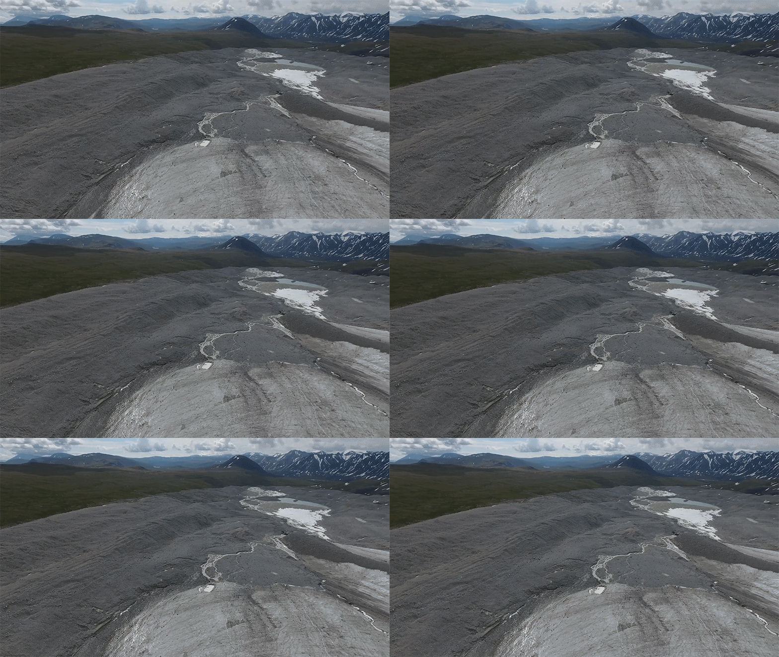
As Putnam hikes past the margin of the modern glacier, a thick stream of milky water flows out of a field of gray rock. From this vantage, the moraine ridges expand outward, each one representing a moment in the past, carved into the landscape: a time when the climate was cooler and the ice expanded. The base camp is at an elevation higher than 10,100 feet. Over the coming days, we will walk the entire length of each moraine ridge, the team collecting dozens of rock samples.
“This is the nexus of climate, humans, and geology, and it is all happening right here,” Putnam says.

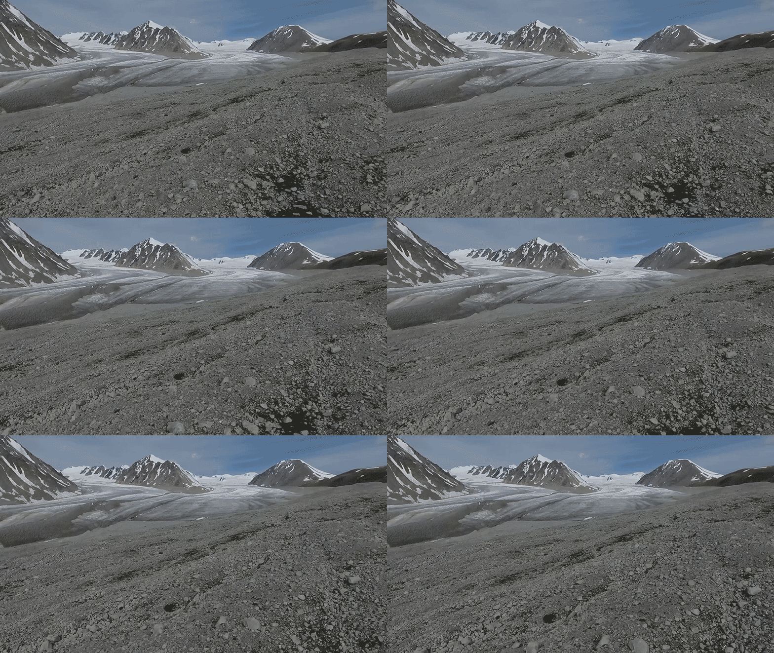
The expedition to the border of Mongolia in the Altai Mountains is a five-day drive across steppe lands — an expanse of semi-arid grassland — and begins on a single-lane, paved thoroughfare out of the capital city of Ulan Bator. Soon the road splits into sandy tracks, crisscrossing like the branches of a tree. Cars pass through the outer rings of the city along streets lined with brightly colored roofs — blues and reds. In the countryside, people live in gers, traditional homes insulated by felt and supported by wood.
We fill three SUVs outfitted with black snorkels for river crossings; a Russian gear van follows behind. At the glacier, our campsite is next to a towering moraine. On the first field day, Peter Strand and I cross a meltwater stream by stepping from rock to rock. He is Putnam’s Ph.D. student and is leading the field work. Wet sediment is the glacial equivalent of quicksand, and, after a few moments, I step in the muck, burying my foot.
“To understand climate dynamics, we need to understand why ice ages occur and why they end.”
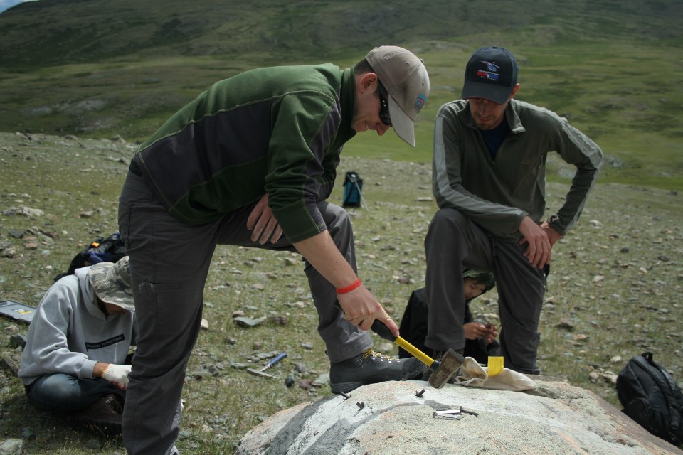
Strand is looking for boulders embedded on the top of the moraine that show evidence of time spent in the glacier. “The ice acts like sandpaper,” Strand explains. Once he has identified a hard granite boulder — brushing it with his fingers to find a polished surface and identifying the spot with permanent marker — he takes a drill out of his pack.
When you’re working at 10,000 feet, you start to notice just how thin the air is. A few people are dizzy. Strand drills several holes, each about the width of a dime, into a granite boulder. Then he places wedges and shims in the holes. After several cracks with a hammer, the pressure of the wedges dislodges a hunk of rock the size of a plate.
The next step is for Mariah Radue, Putnam’s newest graduate student at the University of Maine, to measure the rock’s dimensions, collect GPS coordinates, and use a compass and clinometer to map the heights of surrounding mountains. They repeat this process on every sample, recording every detail in yellow field notebooks, of which Strand photographs each page.
The fieldwork is part of a technique called beryllium-10 surface-exposure dating. These granite boulders were once suspended in the ice, having been dislodged from the mountain peaks by the glacier’s formation. The ice melted and deposited the rock on the ridge. At that moment, the granite was exposed to a flux of secondary particles created when cosmic rays from outer space collided with Earth’s atmosphere.
The particles bombard the rock and affect oxygen and silicon in quartz, creating a cosmogenic byproduct, an isotope called beryllium-10. These atoms accumulate in the rock surface and can be measured to determine how long ago the boulder was freed from the ice and dropped on the land. The Altai samples will be sent back to Maine, where they will undergo chemical processing. Once dated, these samples can reconstruct glacier movement, and the researchers can then draw inferences about how Mongolia’s glaciers changed over thousands of years. “To understand climate dynamics, we need to understand why ice ages occur and why they end,” Putnam tells me.
(Photo: Kevin Stark)
The end of the Ice Age represents Earth’s last great episode of abrupt global warming. In the past, researchers used long cylinders of ice pulled from deep inside the vast frozen reserves of Antarctica and Greenland to study this event. These shafts contain bubbles of atmospheric gas and pollen, material that scientists use to develop an accurate record of past temperature, and to study the role of Earth’s orbital cycle and gases in controlling Earth’s temperature. Currently, the levels of CO2 and other greenhouse gases are higher than they’ve been in hundreds of thousands of years, if not longer. Richard Alley, of Penn State University, says that, as CO2 rises in the atmosphere, temperature follows. “It’s absolutely clear,” he says. “When you turn a slow knob, you get the response to that knob.”
This data is precise, but the information is limited to ice that formed at the Earth’s poles, storing away gas and pollen. With surface exposure dating, suddenly records from mountain glaciers across the world are in play, vastly expanding our ability to interpret this period of warming. Researchers are now fanning out across moraine systems from South America to the North Atlantic, feverishly collecting samples and comparing the results. Many of them have been trained by Joerg Schaefer. He works at Columbia University’s Lamont-Doherty Earth Observatory, where he established the chemistry of the beryllium technique in the early 2000s. His goal was to create a precise dating tool with universal application for glacial geology and climate science. “We now have the most trustworthy summer temperature curve between the poles,” Schaefer says.
Since the Industrial Revolution, Mongolia’s temperature has risen by more than twice the global average. Much of the country’s economic activity has been derived from its vast pasture lands — yet a large area is turning to desert, threatening the way of life of its rural people.
The expanding record suggests that temperature change can happen much faster than was previously thought. “One spectacular thing that has arisen is the realization that these ice ages don’t end slowly,” Putnam says. “They end very rapidly—with an extraordinary warming that is much faster than can be explained by classical theories about what drives the climate system.”
The next step is to integrate this new information into the climate models that predict future warming, so that they can provide clear direction to world leaders confronted with the challenge of adapting to a hotter planet, rising sea levels, and increasing drought. “More than answering any individual question, we added a new insight into the climate system,” Schaefer says. Today, if emissions continue unabated, the planet could be further transformed by heat waves and drought. In the future, it may no longer be able to support vast populations of humans.
This year, we experienced the hottest month ever recorded by human instruments, according to the National Aeronautics and Space Administration, while 14 of the 15 hottest recorded years have occurred since 2000. “You can see how you can damage things you care about by turning up CO2,” Alley says. “The uncertainties, the jumps you see in the past” can be quite scary — especially in the context of anthropogenic climate change. It’s a warning written right here, in these rocks.

Putnam is hammering a boulder with a forearm-sized chisel. His swing slips, and the hammer connects with his hand, breaking his skin. He continues hammering until the rock is broken free. He’s showing his graduate students an older technique that was used before researchers introduced drills and wedges into the field. As Radue takes over with the chisel, Putnam asks Scott Travis if he’s seen the first aid kit.
(Photo: Kevin Stark)
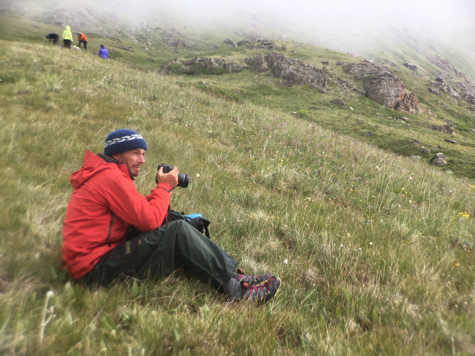
Travis is an affiliate with the Comer Family Foundation of Chicago, which is — along with the National Science Foundation — funding this expedition. Travis has been a research assistant on trips to Greenland, New Zealand, Patagonia, and Bhutan, including several with Putnam. He’s watched Putnam grow from a college student into an established scientist. “Aaron is a sponge,” he says. Even after a full day of fieldwork, he is “always up until 2 a.m. reading papers by headlamp,” Travis says.
Putnam has been on field expeditions for nearly his whole life. His father, David Putnam, is a geo-archaeologist at the University of Maine–Presque Isle, and the son grew up working with the dad. His experience is clear in the routine he’s established for the crew: The mornings begin with flying an aerial drone with a high-resolution camera attached. After breakfast, the team walks a line of boulders collecting samples until night approaches. Hardly any time is wasted.
At first, the drone was something of a wildcard. It’s operated by Travis. The research team has limited experience with drones and will essentially be learning on the job — a fact that makes everyone nervous. Drones are a new tool for glacial mapping. There are stories of research drones disappearing mid-flight or crashing. Travis was practicing flying a drone in his backyard when a low battery triggered an automatic flight pattern that took it careening into a poplar tree.
But the advantages are worth the risk. High-resolution maps are crucial to understanding the glacial history of the area, and, in the past, glacial geologists have had to depend on satellite images and expensive helicopter flights to get detailed images. The Google Earth imagery of the Altai is poor, so the team is excited by the images from the first flight — photographs that show nearly every contour of the landscape. “There is so much value in understanding a complex landscape from the air,” Radue says.
Even at the beginning of July, a close look at the Potanin Glacier reveals a web of meltwater streams and rivers. These are the result of climate change: During a period of rapid warming, a glacier’s equilibrium is disrupted. The ice must re-calibrate, which means expelling water.
Since the Industrial Revolution, Mongolia’s temperature has risen by more than twice the global average. Scientists have observed that lakes are evaporating and glaciers are receding. Much of the country’s economic activity has been derived from its vast pasturelands — yet a large area is turning to desert, threatening the way of life of its rural people. Mongolia has warm summers and dry, very cold winters, and monthly temperature can swing more than 45 degrees Celsius. Regional climate change, in combination with overgrazing, has degraded the pasturelands and threatened the growing mining and agricultural sector, which are dependent on water availability.
We leave the Potanin Glacier on a frigid morning. The ground is covered in frost, and we are nearly out of food. I eat dry bread and jam with a cup of instant coffee. After about 10 days in the field, my metabolism is ferocious, and I’m hungry again almost immediately.
In the following days, we hike over the Takhilt Pass (or very near it; our maps are unclear) at an altitude higher than 10,000 feet. Our guide is Gantuaga, and he does not have a family name. We address him by his given name, Ganna. (Full names in this part of Mongolia generally consist of the father’s name and the given name, in that order.)
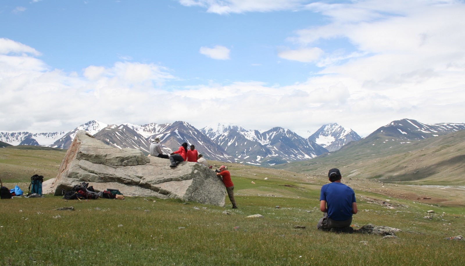
Gantuaga rides on horseback, leading the pack of camels with our sampling gear and food over shrubs and craggy bedrock. We eat lunch — pickles, potatoes, carrots, rice, and freshly slaughtered mutton — at the base of the pass. A few of us are sick from the altitude. Gantuaga whistles and kicks the camels along. Afterward, we descend into the Takhilt Valley, a thin riverbed valley filled with yellow, purple, and blue wildflowers. We camp in a field of tall poppies and wild onions with straw blossoms.
(Photo: Kevin Stark)
The valley is lush with thick grass, all the plants are large, and the rocks are weathered and covered in thick layers of lichen. When the group was at the Potanin, we would often see storms in the distance that barely missed our base camp. The towering valley walls above the Takhilt Valley seem to funnel this precipitation. We spend four days here, saturated, our feet wrinkled like dried fruit. “It’s the perfect condition for someone to become hypothermic,” Putnam says. The morphology in the area is ideal for sampling, but the team is not able to find many boulders. We warm ourselves with hot soup and instant cocoa.
I’m happy to leave this valley, if only to get a chance to dry my boots. Our next destination is the Khoton Nuur tributary valley, a wide-open landscape that was once the home to a massive glacier that has completely melted away. On the hike, the trail disappears into the tributary valley, and we bushwhack through swamp and brush until we find a small trail that runs along a river. The mosquitoes chew on any exposed flesh, and, in the distance, Gantuaga signals to us that our train of camels is stuck in the thick mud.
Tired, we arrive at our next campsite. Putnam and Strand have worked extensively in this valley, and it’s a place they have grown to love for its beauty and its rivers that are full of Mongolian Grayling, which they catch with fly rods. Arctic Grayling are usually only found in the Baikal drainage system that links to the Arctic Ocean and waterways that are connected to it. That makes their presence here another mystery. “The question is, how did grayling in general get into the interior of Mongolia?” Putnam asks. “They are completely isolated here, totally landlocked, and we have no idea why.”
We celebrate the end of the hike with Gantuaga and his team of guides and camels, all of us drinking vodka. After several rounds, I wobble to my tent and fall asleep, immediately. My eyes are open barely long enough to register the brilliance of the evening’s stars.
We spend the next 10 days working in different areas in the Khoton Nuur Valley, down the whitewater stream in the hillsides above the glacial-fed Khoton Nuur Lake, and at moraines that mark where the Potanin Glacier likely stood at the end of the Ice Age. We stop in an occasional town to buy supplies, eat meat dumplings, and drink a salty milk tea. We then drive five days back to the capital city of Ulan Bator to process the samples and prepare them for shipment back to the University of Maine. In the outskirts of the city, the exhaust and smog is a thick blanket, and we pass several coal-fired power plants that provide electricity to the city.
After settling into a hotel in Ulan Bator, the team drives to the Mongolian University of Science and Technology. Strand and Radue prepare the samples for shipment, working out of a geology classroom with long benches and science posters tacked to the wall. Each sample is in an individual canvas bag, sample information carefully written in permanent marker.
Near the end, Putnam is relaxed. The fieldwork is completed. He says that he’s at the bottom of a “checklist the length of both of my arms.” Looking over the 120 rock samples, he’s clearly pleased. After the samples ship, Putnam and Strand will spend the next months and even years processing the rocks in the lab. Once they have clear dates, they’ll compare that information with samples from New Zealand and elsewhere in the Southern Hemisphere, in hopes that a comprehensive chronology of the end of the Ice Age can help us better anticipate whatever abrupt changes the present climate holds in store.
Listen to Kevin Stark’s audio journey to Mongolia, produced for the Warm Regards podcast.


