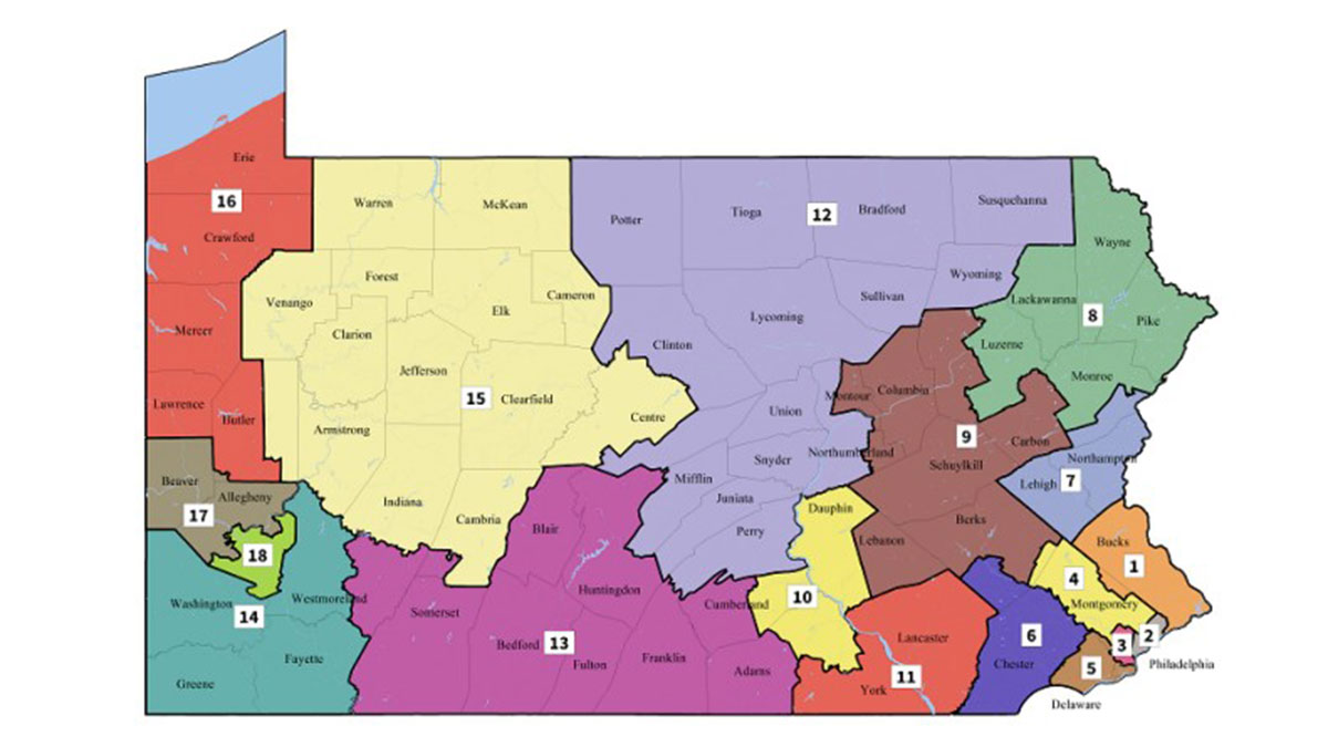
Reaching its self-imposed deadline on Monday, Pennsylvania’s Supreme Court released a new congressional district map, which re-drew new boundaries for the state’s 18 congressional districts.
The overhaul and introduction of new boundaries comes after the court found the previous map, adopted in 2011, was an unconstitutional gerrymander. Judges found the previous map to grant too great of an advantage to Republicans based on the boundaries’ arrangements. The new map will likely give Democrats a higher chance in winning seats in future elections.

“I applaud the court for their decision and I respect their effort to remedy Pennsylvania’s unfair and unequal congressional elections,” Pennsylvania Governor Tom Wolf, a Democrat, told NBC10 in an email.
The state’s Supreme Court drew up the new map after lawmakers missed the February 15th, 2018, deadline initially issued by the court to come back with a new map that upheld constitutional standards. An opinion issued by the court in February explaining its decision stated the 2011 boundaries lost sight of “protection of essential rights” and “an election corrupted by extensive, sophisticated gerrymandering and partisan dilution of votes is not ‘free and equal.'”
The new boundaries will go into effect for the 2018 elections, starting with the May 15th, 2018, primary elections, pending Republican challenges to the new map.


