(Image: Joshua Stevens/NASA Earth Observatory)
Much of America awoke to record-breaking, bitter cold on Wednesday morning. The warmest morning temperature in Minnesota was -17 degrees Fahrenheit, in the town of Grand Marais; the Star-Tribune even posted a video of stunts that readers can pull off in the extreme cold. Minnesotans can try making frozen soap bubbles that remain spherical when punctured, for example, or freeze an egg on the sidewalk, in just a couple of minutes.
Arctic air from a roving polar vortex, now sweeping over New England and the Midwest, is to blame. The polar vortexes are swirling areas of low pressure and freezing air that are typically trapped around the Arctic and Antarctic. However, disturbances can send parts of the Arctic polar vortex down over Canada and the northern United States. In recent years, a growing body of studies has demonstrated that climate change may make the Arctic polar vortex more unstable and apt to move south, although more research is needed, as the Associated Press reports.
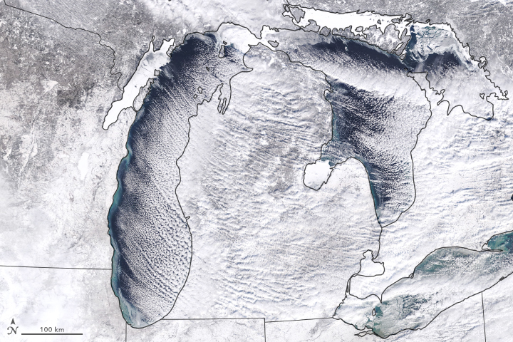
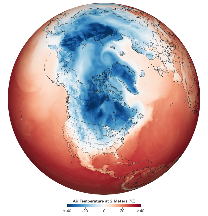
The image above comes from NASA’s Terra satellite. It shows clouds and snow across the some of the Great Lakes, and their surrounding states, on January 27th, just before the coldest temperatures arrived. Below is a visualization of temperatures over North America in the morning of January 29th.

(Image: Joshua Stevens/NASA Earth Observatory)


