More than a century ago, as America’s first national parks began taking shape out West, there really wasn’t too much else out there. Few people back then could imagine a day when those vast swaths—2.2 million acres for Yellowstone; one million for Glacier; three-quarters of a million for Yosemite—would come to seem more like specks amid an ever-growing expanse of human settlement. But at the very least, people thought, any human settlement would be taking place outside the well-defined boundaries of the newly created parks. The wilderness inside of them would always remain a safe, serene habitat for wildlife of all kinds.
But that’s not how it worked out. In 1987, the journal Nature published a scientific paper anchored by a highly alarming finding. After surveying major mammal populations throughout Western parks for the first time, the paper’s authors had discovered that, in the largest parks, one-fourth of the species originally found within park borders had disappeared. Smaller parks had been hit even harder: they had lost up to 40 percent of their original mammalian species.
Remarkably enough, the losses had been predicted—20 years earlier. In 1967, ecologists Robert MacArthur and E.O. Wilson proposed their theory of “island biogeography,” which holds that the rate of extinction on a given island is determined by that island’s size and relative degree of isolation. Over time, it became clear to conservation biologists that this theory applied not only to literal islands but to figurative ones as well: lush mountains that were surrounded by arid flatlands, for example—or, for that matter, pockets of pristine wildlife habitat that were surrounded by development.
How can we identify the “perfect” wildlife corridor—one that proves equally attractive to a lumbering bear, a fleet-winged bird, and a skittering mouse?
An obvious and logical solution presented itself: build bridges between the “islands.” To safeguard biodiversity, conservationists said, we would need to provide some sort of safe pathway for species to travel from one large protected area to another. At first, the experts tasked with drawing up the plans for these earliest wildlife corridors did so by “just looking at a map,” according to Michael Schwartz, a research ecologist at the U.S. Forest Service’s Rocky Mountain Research Station. They tracked the movements of megafauna—think grizzly bears, wolves, and mountain lions—that had been outfitted with clunky radio collars, and designed the pathways accordingly.
Today, scientists can track the movement of so-called focal species, over a season or over a lifetime, with the aid of DNA testing. But while the specifics of the approach may have changed, the larger question remains: If you design a wildlife corridor according to the migratory specifications of one focal species, does it necessarily follow that other species—species that are just as vital to the overall ecosystem—will use it, too?
It’s a question that remains frustratingly unanswered. On a micro level, researchers have compelling evidence that wildlife crossings designed to move creatures—from moose and bears to salamanders and snakes—over and under heavily trafficked roads work very well. But wildlife corridors must cover a much larger area, and address a wide array of obstacles unique to each species. “We’re not certain what [a corridor] captures yet, and what its weaknesses are,” says Rob Ament, a professor at Montana State University and the Road Ecology Program Manager at the Western Transportation Institute. “A grizzly bear corridor might completely leave out moose.” In short, he admits: “We don’t know.”
Hiding inside all that uncertainty, however, is an enticing challenge. How can we identify the “perfect” wildlife corridor—one that might prove equally attractive to a lumbering bear, a fleet-winged bird, and a skittering mouse? More broadly, how might wildlife managers and conservationists go about designing, right now, the sorts of healthy, well-balanced ecosystems that Mother Nature herself required eons to hone and refine?

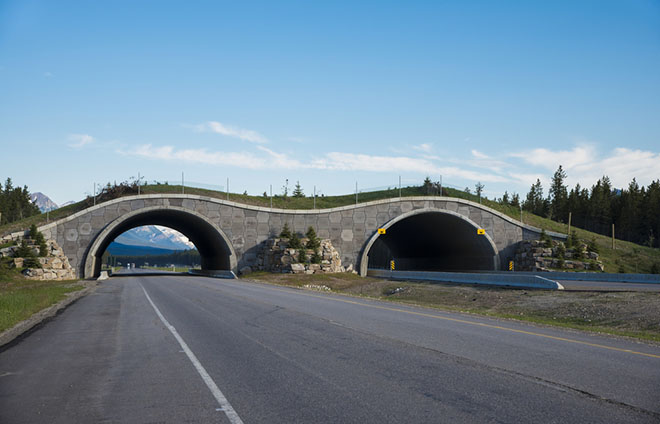
Highway crossing bridge for animals, Banff National Park, Canada. (Photo: Robert Crum/Shutterstock)
The solution is: software. Since the 1990s, corridor planners have been using it to map the optimal routes between discrete wilderness areas—designing those routes, typically, with a single focal species in mind. But several years ago, the Forest Service’s Schwartz teamed up with Carla Gomes, a computer scientist at Cornell University, to see if the two of them could design a program that would take multiple species into account—as well as the costs of various land parcels (and the often limited budgets for buying them). “We already have fantastic algorithms to solve problems that are similar to the corridor problem,” says Gomes. The ultimate goal, she says, is to connect two related but unconnected systems—and the model for doing so, she notes, is to be found in the realm of computer science. Creating the perfect wildlife corridor, it turns out, is a networking issue.
To try to incorporate additional variables into corridor planning—the needs of multiple species, the costs of land, the ability of the corridor to remain useful in the face of changes to the landscape, and so on—Gomes is applying a version of a complicated mathematical construct known as the the minimum delay generalized Steiner network problem. This means of analyzing the impact of different variables within a network in order to optimize that network’s capability is most often used in the design of telecommunications systems, where, as Gomes has written, “sabotage, accidents, or random equipment failure may occur,” and where, given the possibility of such disturbances, it is therefore “important to consider redundancy”—i.e., alternative pathways—“in the network design, in order to guarantee that the network remains functional.”
Translated to corridor design, the idea manifests itself as the gradual inclusion of variables and redundancies to a degree that a maximum number of animals, each of them with different needs and proclivities, can travel through it without any single one of them being overtaxed, overburdened, or halted by nature’s version of “equipment failure”—which for wildlife might include deforestation, urbanization, or the conversion of fields to farmland. This approach acknowledges that a truly well designed wildlife corridor doesn’t necessarily represent the best route for any one species, but rather accepts the fact that the best route for multiple species may mean designing a corridor that’s slightly sub-optimal for all of them.
Right now, Gomes and Schwartz are trying to achieve proof of concept by coming up with a tenable design for a corridor that would accommodate grizzlies, wolverines, and lynx. Eventually they hope to be able to add dozens of other species to the mix, but they admit that getting to that point will require much more work. One reason why is that our understanding of species biology—which has vastly improved from where it was a hundred years ago—still can’t tell us exactly how a species will respond to stressors in its habitat.

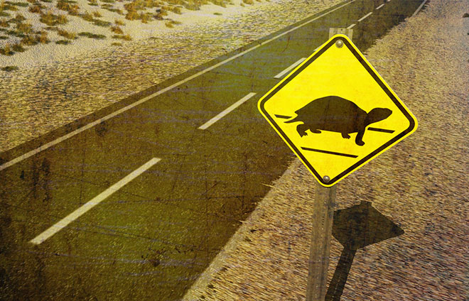
Turtle crossing. (Photo: Anthony Ross/Shutterstock)
“It’s just plain hard,” says Paul Beier, a conservation biologist at Northern Arizona University and the co-founder of corridordesign.org, an open-source website dedicated to the subject. “For pronghorn antelope, for example, we know that road is much worse than grassland—road is hell, grassland is heaven. But is a road a thousand times worse? A hundred times? Ten times? Computer models need numbers.”
With the right numbers, those computer models can better calculate the probability of an animal’s meeting with success or failure as it tries to get from point A to point B. “Wolverines, we know, like spring snow and movement through high country,” says Schwartz. “Grizzlies like riparian zones. Fishers like large forests with large-diameter trees.” While these different aspects of corridor topography may intersect, he adds, “they don’t always. It gets even more complicated when you add in factors like slope, the distance to road, canopy cover, or an animal’s proclivity to be near humans. The mathematics needed to solve this optimization problem can get quite complex.”
And of course, there’s one more variable to consider. “The new frontier, the one that’s still unfolding, is figuring out how to design corridors for climate change,” Beier says. Already, animals are responding to climate change by altering the routes and the timing of their migrations—shifts that can complicate the design process, even as they make the need for well-designed corridors that much more urgent.
Until we can solve these smaller puzzles within the larger puzzle, Beier says, any plans we may have for large-scale national corridors—such as this one, between Yellowstone National Park and the Yukon—remain “worthy experiments that might not succeed.” No corridor designed on such a scale has been fully implemented yet in the U.S., which means there’s little data available to show what might make one successful or not. To address that question, Beier and his research team have applied for funding to study 30 “accidental” corridors around the world—naturally occurring pathways that have somehow managed to survive for decades alongside human development—in order to discern clues that might help them in the task of designing artificial ones.
The good news, Ament says, is that the owners and managers of federal, state, local, tribal, and private lands seem to be on the same page: Establishing wildlife corridors, they all agree, is an important and worthy goal. Once we’ve used some of the world’s most sophisticated networking software to design the perfect corridor, all that will be left to do will be to get these different stakeholders to work together, setting aside large swaths of their land to create safe, unbroken pathways for animals to use. As we’ll undoubtedly learn, that’s a networking challenge of an entirely different sort.
This post originally appeared on OnEarth as “Forging a New Path” and is republished here under a Creative Commons license.


