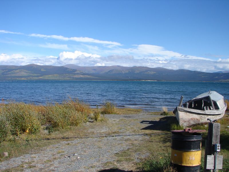
In the fall of 2005, a small floatplane crashed into the cold, dark waters of Kluane Lake. It was early October in the Yukon Territory, and, as winter approached, the always-frigid lake, fed by glacial melt, was even icier than usual. The pilot and his two passengers survived the crash, but now they were in serious trouble.
Luckily for them, a local man had seen the plane go down. He rushed to the boat launch and hurried his boat into the water, then sped out across the lake. He was able to retrieve the three crash survivors within 25 minutes.
Frank Mueller was one of the rescued passengers. He’s the co-owner of Ruby Range Wilderness & Fishing Lodge, which is located on the lake’s Talbot Arm and is only reachable by boat or floatplane. More than a decade after the crash, he worries about future travelers in need of rescue. “If the situation would happen right now,” Mueller says, “I probably wouldn’t be here.”
That’s because Kluane Lake is different now. Like most large Yukon lakes, Kluane is a narrow crevice between the glacier-clad mountains: It’s 50 miles long, and, in places, is up to 300 feet deep. It’s fed by silty runoff from the massive, melting glaciers in the icefields of the St. Elias mountains.
In late May of 2016, the lake’s primary water source, the Slims River, dried up in a matter of days. The Slims had been a wide, braided, fast-moving river that churned along, choked with glacial silt, for about 13 miles from its source, the immense Kaskawulsh Glacier, to the lake’s inflow. But the Kaskawulsh has been in accelerating retreat for years, its ice tongue retracting into the mountains, and, one day in May, it crossed a threshold. Instead of being funneled down into the Slims River, the meltwater that pooled in a lake at the glacier’s snout found a new outlet to the east—a channel that had previously been blocked by a mass of ice. Suddenly the water rushed east instead of north, joining the Kaskawulsh River and transforming the Slims River into a wide, empty mudflat, dotted by the occasional pool of stagnant water.
This is a rare phenomenon known as river piracy, and it has implications far beyond the few miles of mudflats and dust storms where the Slims River used to be. The water that once flowed down the Slims went into Kluane Lake, then along the Kluane River, and, eventually, into the Yukon River system that makes its way to an outlet on the Bering Sea. Now it follows the Kaskawulsh River to the Alsek River and, finally, to the Gulf of Alaska. The resulting changes cascade along both river systems.
In 2017, an academic article published in the journal Nature Geoscience attributed the disappearance of the Slims River definitively to climate change—an occurrence that’s believed to be a global first in modern times. There was only a 0.5 percent chance, the researchers calculated, that the piracy would have occurred naturally, without the accelerating glacier retreat that is being driven by planetary warming. The resulting headlines traveled around the world.

(Photo: Jay Cross/Wikimedia Commons)
But for the people who live along Kluane Lake, it doesn’t matter whether the Slims River was the first or the 10th or the 100th river to be stolen by climate change. What matters are the changes wrought by the river’s disappearance. The water level in Kluane Lake has dropped so far that the existing boat launches are now, as Chief Bob Dickson of the local Kluane First Nation puts it, “high and dry.” “It’s not even touching the water,” he says of the dock in Burwash Landing, the tiny community where the First Nation is headquartered. He figures the lake level may have dropped up to eight feet.
In the summer of 2017, the annual Kluane Lake fishing derby was canceled because the boat launches had become too shallow. In 2018, the event was canceled again. On the lake’s roadless far shore, people are having trouble reaching their cabins. Dickson himself can no longer access some of his typical moose-hunting spots along the Kluane River—its level has dropped too. As the lake that feeds the river shrinks, his boat can no longer navigate the narrow, sheltered channels that it used to.
Then there are the longer-term implications. “Who knows what’s going to happen with the salmon?” Dickson says. “Salmon, and fish in general, need a certain amount of water to spawn, right? They don’t want their eggs frozen in the water. I’m sure that’s going to affect where they go.” Another concern is the temperature of the water: “Because it’s not glacier-fed anymore, that’s going to change—and that’s going to change the fish habitat.”
Researchers are scrambling to get a handle on what it all means. There are scientists studying the dust storms that have kicked up on the old Slims riverbed and government teams tracking temperature and water levels in the areas of the Kluane River where chum salmon spawn. It could be years before we understand exactly what the loss of the Slims River means. “It’s just a waiting game,” Dickson says.
Frank Mueller, for his part, has found a workaround to get his boat in the water and his customers to and from the lodge. It involves driving his truck onto the beach and partly into the lake. But he worries about how quickly rescuers will be able to get to the next crashed floatplane, when that day comes. And he’s alarmed by how quickly the lake he’s fished for 30 years has changed.
“It’s kind of scary when you see it,” he says. “Usually these changes take hundreds of years.”


